
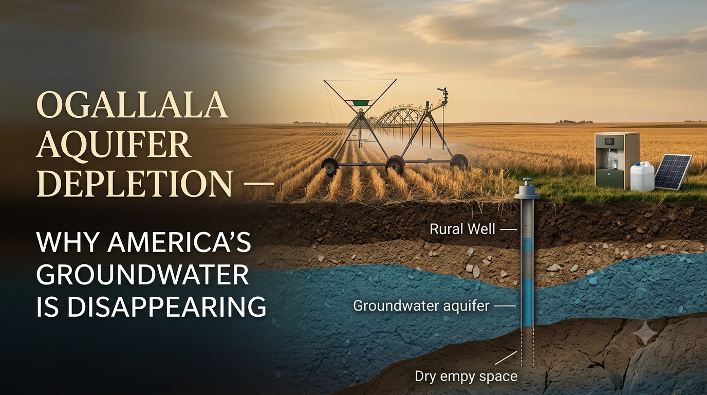
When I first heard someone call the Ogallala Aquifer “America’s underground water bank,” I thought it sounded a little dramatic. Then I looked at the numbers. The High Plains Aquifer, commonly called the Ogallala Aquifer, has lost an estimated 286.4 million acre-feet of recoverable water since predevelopment, according to the U.S. Geological Survey.
That is not a tiny dip on a chart. It is a long-term water problem affecting farms, rural towns, private wells, food production, and household water security across the Great Plains.
This guide explains what Ogallala aquifer depletion means, why groundwater levels are falling, which states are most affected, and what ordinary families can do to prepare without falling into panic mode.
What Is the Ogallala Aquifer?
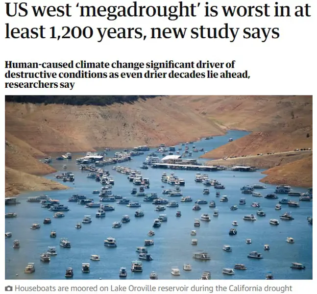
The Ogallala Aquifer is a vast underground groundwater system beneath the Great Plains. Scientists and government agencies often call it the High Plains Aquifer, while many farmers, homeowners, and media outlets use the name Ogallala Aquifer.
It stretches under parts of eight states: South Dakota, Wyoming, Nebraska, Colorado, Kansas, Oklahoma, New Mexico, and Texas. It supports irrigation, livestock operations, public water systems, rural homes, and local economies across a huge area.
Groundwater sits in the spaces between underground sand, gravel, silt, and rock. It is not usually a giant underground lake you could swim through. That was one of my first misunderstandings, honestly.
The water is stored in porous geologic material, then pumped through wells for irrigation, household use, municipalities, and industry. In many parts of the region, this groundwater has been used for decades to grow crops in areas where rainfall alone is not enough.
The U.S. Geological Survey’s High Plains Aquifer report estimates that recoverable water in storage was about 2.91 billion acre-feet in 2019. That sounds enormous, and it is, but the key issue is how quickly water is being removed compared with how slowly it is replenished.
- The Ogallala is also known as the High Plains Aquifer.
- It underlies parts of eight Great Plains states.
- It provides water for farms, ranches, towns, homes, and businesses.
- Groundwater is stored in pores between soil, sand, gravel, and rock.
- Its condition varies widely by location; some areas are more stressed than others.
That last point matters. The Ogallala Aquifer is not declining at one identical rate everywhere. Some areas have seen relatively stable levels or small recoveries, while others have experienced very large drops.
So when you hear “the aquifer is disappearing,” read it as a regional warning with local differences, not a guarantee that every well across eight states will fail on the same day.
What Does Ogallala Aquifer Depletion Mean?
Ogallala aquifer depletion means that groundwater is being removed faster than it can be naturally replaced through recharge. Recharge mostly happens when rain and snowmelt soak through the ground and eventually reach the aquifer.
In much of the High Plains, recharge is slow. Rain does not simply fall today and refill a heavily pumped aquifer tomorrow. Soil type, geology, vegetation, evaporation, temperature, and land use all affect how much water makes it down to groundwater.
The basic equation is pretty simple, even if the real science is not: when pumping exceeds recharge over a long period, groundwater levels fall.
According to USGS monitoring, the area-weighted average water level in the High Plains Aquifer declined 16.5 feet from predevelopment through 2019. Individual wells showed very different outcomes, ranging from an 86-foot rise to a 265-foot decline.
That huge range is why a local map matters more than broad headlines. Still, an average decline of 16.5 feet across such a massive system is not something to brush aside.
- Depletion occurs when water withdrawals exceed natural recharge.
- Recharge in the Great Plains can be slow and highly variable.
- Groundwater pumping for irrigation is the largest source of withdrawals.
- Water levels can decline faster during drought and heavy irrigation seasons.
- Some wells may need to be deepened, replaced, or pumped harder as water levels fall.
The U.S. Geological Survey reports that about 95% of groundwater pumped from the High Plains Aquifer in 2015 was used for irrigation. That does not make farming “the bad guy.” It shows how deeply food production and groundwater are connected in this part of the country.
When I think about it, this is less about blaming one water user and more about facing the math. A resource can be essential and still be used faster than nature can replace it.
Why Is the Ogallala Aquifer Disappearing?
The biggest reason for Ogallala Aquifer depletion is intensive groundwater pumping for irrigation. Large areas of the Great Plains receive limited and unpredictable rainfall, so irrigation became the engine that allowed higher crop production.
Since major groundwater irrigation expanded around the 1950s, water levels have declined in many parts of the aquifer. The pattern is especially serious in portions of Texas, Oklahoma, and southwestern Kansas.
The USGS explains groundwater-level declines as an imbalance between discharge, primarily irrigation withdrawals, and recharge, primarily from precipitation. That is the core issue in plain language.
Drought adds pressure because farmers may need to pump more when rainfall is low. Hotter temperatures can also increase irrigation demand and evaporation, making it even harder to balance withdrawals with recharge.
- Large-scale irrigation is the main driver of groundwater withdrawals.
- Low rainfall makes farming more dependent on pumped groundwater.
- Drought can increase irrigation demand.
- Hot temperatures raise evaporation and crop water needs.
- Population growth and municipal demand can add local pressure.
- Natural recharge may be too slow to replace decades of pumping.
It is worth remembering that irrigation made food production possible in places that otherwise would have had much lower yields. That was a real benefit. But the groundwater tradeoff was not always obvious in the early years because wells kept producing.
Then the water table drops. Pumps work harder. Electricity costs rise. Well yields can weaken. It happens quietly for a while, then suddenly it feels very personal to the people depending on that water.
NOAA’s climate resources explain that producers in parts of the region are extracting water faster than it is replenished, which means some areas of the aquifer are effectively being treated as a nonrenewable resource on a human time scale.
Which States Are Most Affected by Groundwater Decline?

The High Plains Aquifer crosses eight states, but water-level decline is not evenly spread. Nebraska holds a large share of the aquifer’s total groundwater storage, while the southern and central areas have generally experienced more severe depletion.
Texas, Kansas, Oklahoma, eastern Colorado, and parts of New Mexico have faced some of the strongest long-term declines. In some locations, water levels have fallen by more than 100 feet, and USGS monitoring has documented individual declines of up to 265 feet from predevelopment through 2019.
That is why state-by-state and county-by-county information matters. A household in western Kansas may have a completely different water outlook from one in central Nebraska.
The USGS High Plains Water-Level Monitoring Study provides maps and data showing these regional differences. It is one of the best places to start if you own land, operate a well, or are considering moving to a rural area in the region.
- Texas: Some of the largest long-term declines have occurred in parts of the Texas Panhandle.
- Kansas: Southwest Kansas has experienced major irrigation-related groundwater stress.
- Oklahoma: Portions of the Panhandle rely heavily on High Plains groundwater.
- New Mexico and Colorado: Some areas face limited recharge and long-term well concerns.
- Nebraska: Holds substantial aquifer storage, but local conditions still vary and should be monitored.
I would avoid saying every state is “running out of water” in the same way. That’s too broad, and it scares people without helping them.
A better approach is to check your county groundwater district, local extension office, state water agency, or a qualified well professional. Specifics beat doom-scroll headlines every single time.
How Aquifer Depletion Affects Farms, Wells, and Food Prices

When groundwater levels decline, the effects spread beyond the pump house. Agriculture is often affected first because irrigation is such a large user of High Plains groundwater, but the impacts can reach homes, local businesses, and food supply chains too.
As the water table falls, pumps may need to lift water farther. That can increase electricity or fuel costs. Some wells may produce less water, while others need to be repaired, deepened, or replaced.
The USGS notes that falling groundwater levels can lead to higher pumping costs and decreased well yields. That one sentence has a lot packed inside it, because a lower-yield well can change what crops a farm grows, how much acreage is irrigated, or whether a household needs a new water plan.
- Lower water tables can make wells more expensive to operate.
- Some irrigation wells may produce less water over time.
- Farmers may change crops, reduce irrigated acres, or invest in efficiency upgrades.
- Rural communities may face higher infrastructure and water-treatment costs.
- Food production changes can influence regional jobs and consumer prices.
It is tempting to connect every grocery-store price increase to groundwater depletion, but that would be sloppy. Food prices are affected by fuel, labor, weather, transportation, fertilizers, global markets, and a dozen other things.
Still, reliable water is a basic ingredient in agriculture. When it gets scarcer or more expensive to access, it puts added stress on the entire system.
For private well owners, the most helpful move is basic monitoring. Pay attention to pressure changes, pumping cycles, air sputtering from faucets, unusual sediment, and any change in water taste or clarity.
Can the Ogallala Aquifer Refill Naturally?
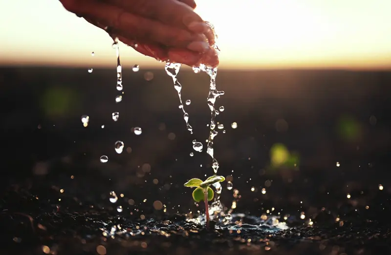
Yes, the Ogallala Aquifer can receive natural recharge. But the important question is not whether recharge happens. It does. The question is whether recharge can keep up with withdrawals in heavily pumped areas.
In many parts of the southern High Plains, it cannot. Rainfall may be limited, evaporation may be high, and the geology may allow only a small share of precipitation to reach the aquifer.
That means recovery can be slow on a human time scale. A wet year may improve local conditions, but it does not necessarily erase decades of groundwater decline.
The National Climate Assessment summary published by NOAA states that producers are extracting water faster than the aquifer is replenished and notes that parts of the Ogallala should be considered nonrenewable at a human time scale.
- Recharge occurs when precipitation and runoff move downward into groundwater.
- Recharge rates vary by soil, geology, rainfall, land cover, and climate.
- Some aquifer areas may recover slightly during wet periods.
- Heavy long-term pumping can exceed recharge for decades.
- Water conservation can slow depletion even when rapid full recovery is unrealistic.
I think this is where people get tripped up. They hear that the aquifer has “some recharge” and assume that means it will naturally bounce back.
It might recover in limited places, under certain conditions. But a savings account with a small monthly deposit still goes down if withdrawals are much bigger every month.
What Can Farmers and Communities Do to Slow Depletion?
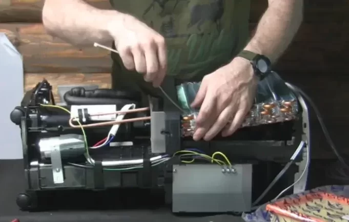
There is no single fix for Ogallala Aquifer depletion. The response usually involves a mix of smarter irrigation, crop choices, local groundwater rules, conservation programs, better measurement, recharge projects where feasible, and long-term planning.
Some farmers have moved toward more efficient irrigation technology, soil-moisture monitoring, lower-water crops, deficit irrigation, and practices that help retain soil moisture. These changes may not solve every problem, but they can stretch available water further.
Communities can also support well monitoring, leak reduction, drought planning, water reuse where appropriate, and public education. The boring local work counts more than flashy claims.
- Use soil-moisture sensors to avoid unnecessary irrigation.
- Improve irrigation-system efficiency and repair leaks quickly.
- Consider crops and planting schedules that fit local water realities.
- Track groundwater levels through local districts and state agencies.
- Support conservation programs and realistic groundwater-management goals.
- Protect recharge areas from contamination and harmful land-use practices.
Good water management is not glamorous. It is spreadsheets, soil probes, pipes, local meetings, and sometimes hard choices about what cannot be grown the same way forever.
But slow improvements matter. And communities that measure what they use usually have a better chance of managing the resource than communities that guess.
How Households Can Build a Practical Water Backup Plan

Most families cannot control regional groundwater policy. But they can understand their own water supply and build practical layers of preparedness.
The Centers for Disease Control and Prevention recommends storing at least one gallon of water per person per day for at least three days in an emergency. More may be needed in hot weather, for pets, young children, older adults, and some medical situations.
That is the first layer. It is simple, affordable, and very useful.
- Store emergency water in clean, food-grade containers with tight lids.
- Know whether your home relies on a private well, rural water district, municipal utility, or hauled water.
- Schedule well inspections and water-quality tests when recommended locally.
- Keep a basic filtration and water-treatment backup plan.
- Learn local rules for rainwater collection and emergency water storage.
- Fix household leaks and track unusually high water use.
For households wanting another layer beyond stored water, an atmospheric water generator may be something to research. These systems use condensation to collect water from humid air, but their performance varies a lot with humidity, temperature, energy use, design, maintenance, and water treatment.
Joseph’s Well is marketed as a DIY atmospheric-water-generator guide that includes build instructions, blueprints, a materials list, and on-grid or off-grid power guidance. It should be considered a potential supplemental preparedness tool, not a guaranteed household water supply.
You can read the Joseph’s Well review before making any purchase decision. That gives you a chance to compare the claimed approach with your climate, household needs, and budget.
Can an Atmospheric Water Generator Help When Groundwater Is Limited?

An atmospheric water generator can potentially provide a supplementary water source, but it should not be marketed as a one-device answer to aquifer depletion. If local groundwater is declining, the responsible move is to use several layers of water security.
Atmospheric water systems work by cooling humid air until water vapor condenses. This means they usually perform better in warm, humid areas than in dry, high-plains or desert conditions.
That is the part I would check first. A system that works well in a humid southern summer may produce far less in a dry, windy region.
The EPA’s atmospheric water generation technical brief notes that water collected from these systems requires careful monitoring and treatment for safe drinking use.
- Check local humidity and dew-point patterns before considering an air-to-water system.
- Plan for the electricity or solar-and-battery capacity needed for condensation.
- Use food-safe storage, filtration, sanitation, and water testing.
- Keep emergency water storage even if you add a DIY water generator.
- View water-from-air collection as a supplemental option, not a replacement for local water planning.
If you want to see what the Joseph’s Well offer includes, you can view the current DIY water-guide details here. Read the product information carefully and treat any advertised output or cost figures as vendor claims that may vary by local conditions.
Conclusion: Ogallala Aquifer Depletion Is a Long-Term Water Reality
Ogallala Aquifer depletion is not a distant science story. It affects farming, rural communities, wells, groundwater costs, and long-term water security across the Great Plains.
The aquifer is not disappearing at the same rate everywhere, but USGS data makes the broad trend clear: in many heavily pumped areas, groundwater has been withdrawn faster than it can naturally recharge.
The best response is steady, not frantic. Follow local groundwater information, conserve water, monitor wells, keep emergency water stored, and build sensible backup options one layer at a time.
You cannot refill a regional aquifer by yourself. But you can make your household less vulnerable if water becomes harder, slower, or more expensive to access.
Sources and Further Reading
- U.S. Geological Survey: High Plains Aquifer Water-Level and Storage Changes Through 2019
- U.S. Geological Survey: High Plains Water-Level Monitoring Study
- U.S. Geological Survey: Water-Level Changes in the High Plains Aquifer
- NOAA Climate.gov: Great Plains Ogallala Aquifer Drying Out
- Centers for Disease Control and Prevention: Create and Store an Emergency Water Supply
- U.S. Environmental Protection Agency: Atmospheric Water Generation Technical Brief
- Joseph’s Well Review